Skip to Main Content Area
ASU Home
Colleges & Schools
A-Z Index
Directory
Map
SIGN IN
Search
Home
About Us
Contact Us
Resources
GeoContests
Maps
Virtual Workshops
Search
n/a
Home
Search: Search Terms
Maps
World
The World (centered on the Atlantic Ocean)
The World (centered on the Pacific Ocean)
The Western Hemisphere
The Eastern Hemisphere
The Northern Hemisphere
The Southern Hemisphere
Standard Time Zones of the World (B&W)
Standard Time Zones of the World (color)
Countries with Populations Greater than 50 Million
The World’s Major Mountain Ranges
Tropical Storms
Rainforests of the World
Monsoon and San Juan's Day
Where Plates Collide: Land Areas
World Map in 6 tiles (B&W)
The World's Tectonic Plates
The World's Tectonic Plates (labeled)
The World's Extreme Elevations
World Map in 12 tiles (color)
Continents and Regions
Africa
African Regions
African Regions (labeled)
Antarctica
Asia
Australia and New Zealand
Europe
Capital Cities of Central and Eastern Europe
North America
South America
South America's Capital Cities and Countries
Latin America
Middle America
The Pacific Rim
The European Union
The European Union (countries labeled)
The Former Soviet Union (countries labeled)
The Mediterranean
The Greek Diaspora
Central Asia
East Asia
South Central Asia
Southeast Asia
Southwest Asia/ North Africa
Southwest Asia/ North Africa (countries labeled)
Oceania Culture Regions (island groups labeled)
US-Mexico Border States
US-Mexico Border States (states labeled)
Africa's Resources
Arizona
Arizona
Arizona and its Neighbors
Arizona and its Neighbors (labeled)
Pima Territory of Arizona in 1700
Historical Development of Arizona and New Mexico Boundaries
Historical development of Utah and New Mexico Boundaries (color)
Historical development of Utah and New Mexico Boundaries (B&W)
Arizona’s Population Growth
Arizona’s Cities, with Compass Rose
Central Arizona Project: A Story About Water
Arizona Dams
Arizona’s Indian Reservations (B&W)
Arizona’s Indian Reservations (color)
Arizona Mining Towns
Arizona’s State and National Parks
Arizona’s Topography
Physiographic Provinces of Arizona
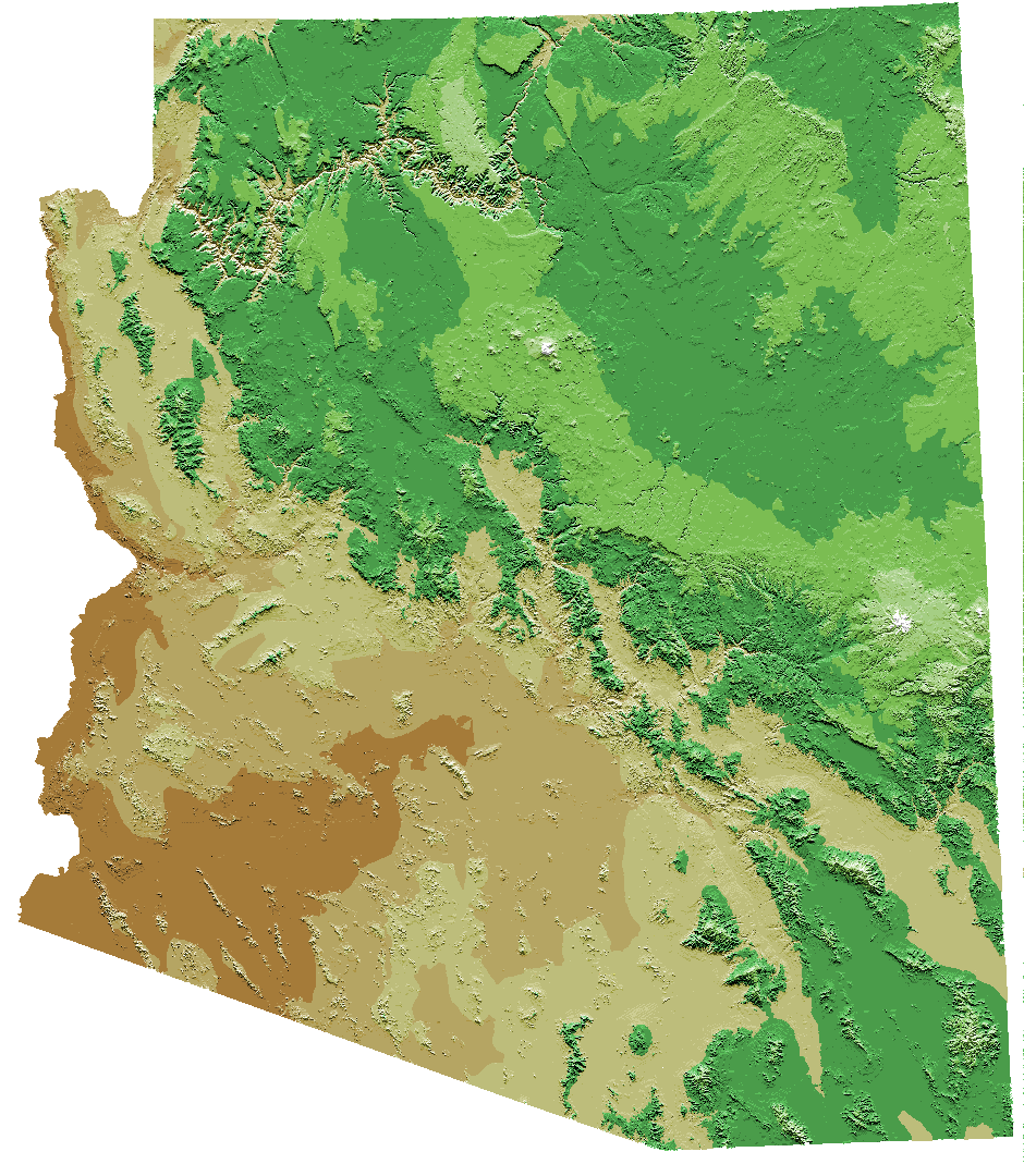
Arizona’s Relief (color, courtesy USGS)
Arizona’s Landforms and Rivers
Arizona’s Watersheds (color)
Arizona’s Watersheds (B&W)
Important Streams, Rivers and Washes of Arizona
Important Streams, Rivers and Washes of Arizona (with directions of water flow marked)
Landform Regions of Arizona (labeled)
Landform Regions of Arizona (unlabeled)
Arizona’s Biomes
Normal Rainfall in Arizona
Elevations along the Colorado River in the Grand Canyon
Hike to Indian Garden Topographic Map
The Sonoran Desert
Landmarks in Arizona (B&W)
Landmarks in Arizona (color)
Landmarks in Arizona (poster size)
Arizona Counties
National and State Parks in Arizona
Prehistoric Cultures of the Southwest
Countries
Japan’s provinces, with latitude-longitude grid
Bangladesh (3 maps)
Brazil (3 maps)
China (3 maps)
Democratic Republic of the Congo (3 maps)
Egypt (3 maps)
Ethiopia (3 maps)
France (3 maps)
India (3 maps)
Indonesia (3 maps)
Iran (3 maps)
Italy (3 maps)
Japan (3 maps)
Mexico (3 maps)
Nigeria (3 maps)
Pakistan (3 maps)
Philippines (3 maps)
Russia (3 maps)
Thailand (3 maps)
Turkey (3 maps)
United Kingdom (3 maps)
The United States (3 maps)
Vietnam (3 maps)
Canada (3 maps)
US and Southwest US
The United States
The United States (states labeled)
The United States (color, states labeled)
Giant United States Map (to be assembled)
The United States with State Abbreviations
The United States with State Capitals
The United States with State Capitals (labeled)
The United States (half page)
Regions of the United States
Regions of the United States (colored)
The United States - US Bingo
U.S. Capitals Location Lesson Map
The Oregon Trail
Physical Regions of the United States
Physical Regions of the United States (labeled)
Physical Regions of the United States (with elevations)
The United States, Its Major Rivers, and the Continental Divide
Rivers and Cities in the United States
The United States (with major rivers)
Seismicity of the United States, 1977-1997
Disastrous Flash Floods: Number of Fatalities in 2013
Disastrous Heat Extremes: Number of Fatalities in 2013
The Southwestern United States
The Southwest’s Topography and Rivers
The Southwest’s Topography and Rivers (labeled)
The Southwest’s Topography and Rivers (color)
The Colorado and Gila Rivers in the Southwest U.S.
The Sonoran Desert
Prehistoric Cultures of the Southwest
Historical development of Utah and New Mexico Boundaries (B&W)
Historical development of Utah and New Mexico Boundaries (color)
Gadsden Purchase of 1853
The Southwest’s Indian Reservations
The Navajo Long Walk, 1865-1866
Cesar Chavez, Dolores Huerta and the Farmworkers’ 340 Mile March According to "Harvesting Hope”
The Underground Railroad (circa 1860)
1869 Expedition of John Wesley Powell
United States 1841-1869
Code Talker Locations
The Gila Trail
Madonna of the Trail Monument Locations (Labeled)
OR_CA_Map_Labeled_Key.pdf
The Journey of Lewis and Clark
The United States During the Civil War
United States (1787)
Major Arizona Railroads and Roads (circa 1940)
The United States (with state names and electoral votes)
Disastrous Lightning: Number of Fatalities in 2013
Disastrous Tornadoes: Number of Fatalities in 2013
Transportation and Industry in the US in 1860
Transportation and Industry in the US in 1860 (color)
Grades K-4
Continents of the World
Continents of the World (labeled)
Giant World Continent Map (to be assembled)
Arizona
Arizona’s Cities
Arizona’s Cities, with Compass Rose
Arizona’s Counties
Arizona’s Counties (labeled)
Elementary Arizona Road Map
Landform Regions of Arizona (labeled)
Landform Regions of Arizona (unlabeled)
Arizona’s Biomes
Normal Rainfall in Arizona
Arizona Dams
Arizona’s Indian Reservations
Landmarks in Arizona (B&W)
Landmarks in Arizona (color)
Landmarks in Arizona (poster size)
The United States (color, states labeled)
Giant United States Map (to be assembled)
Birds’ Eye View of a Classroom
Classroom Map
Elementary California Road Map
Elementary Oklahoma Road Map
Elementary Oklahoma Road Map (poster: left)
Elementary Oklahoma Road Map (poster: right)
Elementary North Dakota Road Map
Elementary North Dakota Road Map (poster)
The Silk Road
The Silk Road through China
Water Cycle (unlabeled)
Water Cycle (labeled)
Ancient Empires of Mesoamerica and South America (labeled)
Ancient Empires of Mesoamerica and South America (unlabeled)
National and State Parks in Arizona
Galapagos Islands
Ecuador and the Galapagos Islands
Galapagos Islands Ocean Currents
Galapagos Islands Ocean Currents (Labeled)
Giant World Time Zones map (color, 6 tiles)
Giant World Time Zones Map (color, 4 tiles)
Giant World Time Zones Map (B&W, 4 tiles)
Giant World Time Zones Map (B&W, 6 tiles)
Historical Themes
Travels of Marco Polo, 1271-1295
Travels of Ibn Battuta, 1325-1354
The Voyages of Zheng He (labeled)
The Voyages of Zheng He (unlabeled)
The Silk Road
Jerusalem’s Old City
Celtic Round House - Illustration and Plan
Cradles of Civilization (labeled)
Cradles of Civilization (unlabeled)
Moundbuilder Sites in the United States
Tipi - Illustration and Plan
Plan of a Traditional Adobe House
The American Colonies
The American Colonies (labeled)
The United States - 1787
The United States - 1803
The United States - 1819
The United States - 1845
The United States - 1848
The United States - 1853
Transportation and Industry in the US in 1860
The Oregon Trail
Europe Before World War I (1914)
Europe After World War I (1918)
Europe Before World War II (1939) [labeled]
Europe Before World War II (1939) [unlabeled]
Europe After World War II (1945) [labeled]
Europe After World War II (1945) [unlabeled]
Prehistoric Cultures of the Southwest
Pima Territory of Arizona in 1700
Trails of Early Explorers through Arizona
Trails of Early Explorers through Arizona (labeled)
Spanish Exploration of Arizona
American Exploration of Arizona
Mormon Exploration of Arizona
Gadsden Purchase of 1853
Historical Development of Arizona and New Mexico Boundaries
Historical development of Utah and New Mexico Boundaries (color)
Historical development of Utah and New Mexico Boundaries (B&W)
Arizona Dams
Arizona’s Indian Reservations
Arizona Mining Towns
Arizona’s Population Growth
1869 Expedition of John Wesley Powell
Code Talker Locations
The Electoral College
The United States During the Civil War
The United States During the Civil War (Unlabeled)
Orphan Train Railroad Routes
The Underground Railroad
The Navajo Long Walk, 1865-1866
The Oregon and California Trails (1849 - 1850)
Major Arizona Railroads and Roads (circa 1940)
Africa's Resources
Jewish Population in Europe before World War II
Jewish Population in 1995
Transportation and Industry in the US in 1860 (color)
Arizona
Grades K-4
Arizona Landscape Map 4x4 Tile Map (to be assembled)
Arizona Landscape Map
Arizona
Historical Themes
AZ Mormon Wagon Roads - no lakes.pdf
Right menu
GeoLiteracy Lessons
GeoSTEM Lessons
GeoHistory Lessons
Arizona Lessons
Geography and Diverse Learners (ELLs)
Giant Map Activities
Interpreting Primary Sources with a Geographic Lens
Grade Level (K-7) Activity Books
Lesson Lists by Grade Level
AzGA on Facebook
Become a Member
Giant Floor Map Program
Donate